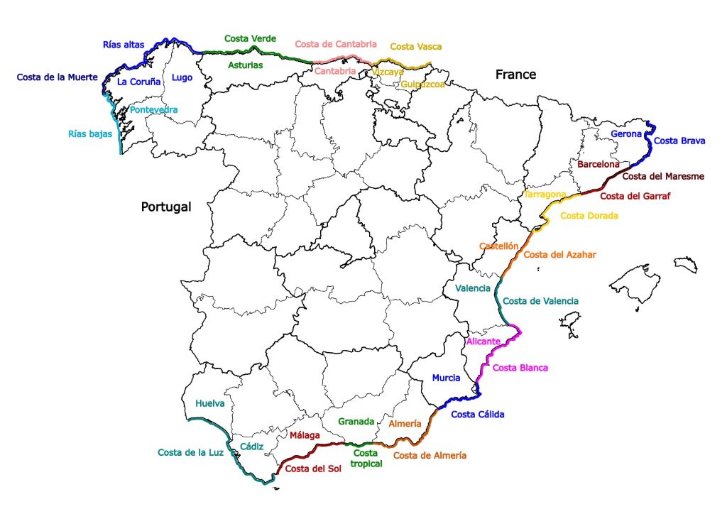
Exploring the 18 Spanish Costas: a dive into their origins
The Spanish Costas are every tourist dream. Lots of sunshine, sandy beaches, picturesque white villages, great food, culture, and history to please all tastes. On top of that, they also have curious and catchy names, such as Costa del Sol (Sunny Coast) and Costa de la Muerte (Death Coast). But do you know the story behind these names, and where each coast begins and ends? That’s what will check on this post, focusing on the peninsular part of Spain and on enjoying the Spanish Costas.
The story behind the names of the Spanish coasts
Some Spanish coasts have traditional names, that dates a hundred years or more, but for the most part, it was the tourism boom that started in Spain during the 1950s that introduced the idea of naming coastal regions with unique, marketable names that would spark curiosity abroad. This led, at first moment, to some confusion, with some names being coveted by more than one coast, or different names in use for the same coast.
During the 1950s, a lot of regulations had to be created to organize the distribution of profits and responsibilities among the national government, the autonomous communities, and the provinces. Spain was, indeed, starting to see tourism as an industry, and a major one.
Therefore, in the 1960s the central government tackled the question of the coast names through a decree: it was the “Orden de 31 de marzo de 1964 por la que se crea en la Subsecretaría de Turismo el Registro de Denominaciones Geoturísticas” something like “Decree of March 31, 1964, in which the registry of geotourism denominations is created”. A boring law name ordering the provinces to register a tourism-oriented name for their coasts!
From that date on, the provinces were obliged to choose a name and register it, officially. That’s why there are so many Spanish Costas, and why, as can be seen on the map, there is a high level of coincidence between the limits of the coasts and the limits of the province or provinces in which they are. Marketing was done with ethics back then, and the decree specify that the chosen name must be based on real aspects of the region. 🙂 And that’s why the names make sense!
Nothing in the decree prevented a province from having two or more coastal names, if they so wished, as long as the coasts didn’t overlap. The province of Barcelona opted to keep two historical names, which were already used for decades (despite none of them being very marketable). Similarly, the provinces in Galicia (Pontevedra, La Coruña and Lugo) have coastal names that do not coincide with the limits of each province, because these names were already known, historical and made geographical sense (but are also not particularly appealing).
Some provinces opted for simply naming their coasts with the name of the province, but most of the Spanish Costas with appealing, marketable names – such as Costa del Sol (Sunny Coast) and Costa Blanca (White Coast) – have either faced a tourism boom around the 1950s / 1960s or tried to join the boom. They got their names around that time, created by local authorities, in observance to the 1964 decree and with the assumed intention of attracting more tourists. The coasts that were named before generally have less-inviting names.
The East (Mediterranean) and South Spanish Costas
Starting from the Mediterranean side, from north to south, we have the following:
Costa Brava
One of the most well-known Spanish Costas, Costa Brava (Wild Coast) is the northmost Costa on the mediterranean side. It gets its name from the rugged cliffs and hidden coves along its shores in the province of Gerona (in Spanish) or Girona (in Catalan). The term was created by the local journalist Ferran Agulló, in the magazine La Veu de Catalunya in 1908, and became the official branding name in 1965. The Costa Brava goes from the border with France to the border with Catalonia, in the Tordera river.
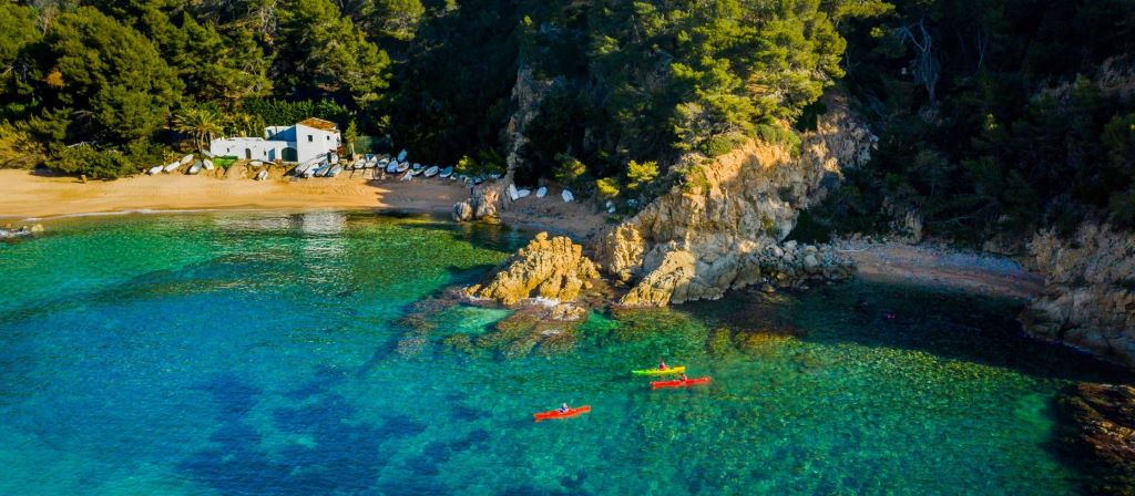
This Costa started to attract visitors around 1930, while it was still only dotted with fishing villages. The tourist infrastructure started to be built around the 1950s, particularly in areas with sandy beaches. Nowadays, one third of the coastal area is set for preservation (meaning, no buildings allowed, but visitation is permitted), which makes this coast a paradise for nature lovers. The city of Lloret de Mar, in the south of the province, is probably the most popular tourist destination in Costa Brava; also notable are the neighbor small villages of Cadaqués and Port Lligat, both connected to Salvador Dalí’s life – he used to spend his childhood vacations in the first and eventually built his house in the second.
Autonomous community: Catalonia
Province: Gerona
Popular or main cities: Lloret de Mar, Tossa de Mar, Cadaqués
Closest airport: Girona-Costa Brava (GRO)
More about the Costa Brava: Costa Brava official website
Costa del Maresme and Costa del Garraf
The Costa del Maresme starts from the Tordera river, which divides the provinces of Gerona and Barcelona, on the north, until the river Llobregat, in the city of Barcelona. The Costa del Garraf (also known as Costa de Barcelona) starts there and continues until the south of the province, where it borders the Costa Dorada and the province of Tarragona.
Maresme means seasickness in Catalan. It may be surprising, as it lacks appeal at first sight, but the name was invented centuries ago, when the Costa del Maresme was often attacked by pirates. Ironically, it seems that their name choice was market-oriented, aiming at repelling the invaders! On the other hand, Garraf means simply bottle in Catalan. I suspect this coast was named after the small village of Garraf, close to Sitges, or after the Garraf Massif, a mountain range that reaches the coast.
Barcelona’s appeal is undisputable. Spain’s second biggest city is one of the main tourist destinations in the whole European continent, and both the Costa del Maresme and the Costa del Garraf benefit from it. Close to Barcelona is the incredibly charming town of Sitges, in the Garraf area, known for its beautiful beaches, festivals and for its welcoming gay community.
Autonomous community: Catalonia
Province: Barcelona
Popular or main cities: Mataró (Maresme), Barcelona (both), Sitges (Garraf)
Closest airport: Josep Tarradellas Barcelona-El Prat (BCN)
More about the coasts: Maresme and Garraf
Costa Dorada
Costa Dorada (in Spanish) or Daurada (in Catalan) translates as Golden Coast. The name refers to the color of the sand under the sunshine and was created in 1964 by the Spanish Ministry of Tourism. The area has several fine sand beaches where the practice of snorkel and kayak are common. Tarragona, known for its ancient Roman ruins, is the capital city of the homonymous province where the Golden Coast is located.
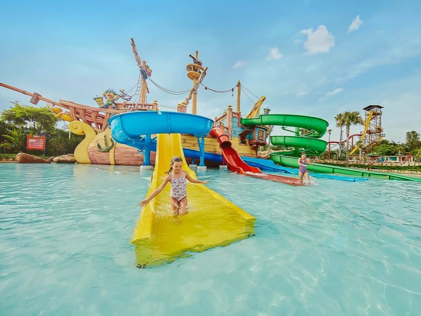
The main attraction of the Costa Dorada is the park PortAventura World, the most visited theme park in Spain, that receives about 5 million visitors yearly. It is called ‘world’ because it is big, indeed; it is a 3-in-1 park, being one aquatic park, one park focused on shows, parades, and thrilling rides and a third one dedicated to all things Ferrari.


Sometimes Tarragona’s Reus Airport is used to access Barcelona, as it is just 95 km away from that city. Low-cost airlines tend to favor this airport as the charges in Reus Airport are smaller than in the busy Barcelona’s El Prat.
Autonomous community: Catalonia
Province: Tarragona
Popular or main cities: Tarragona, Cambrils, Salou
Closest airport: Reus Airport (REU) (works only from May to September)
More about the coast: Costa Dorada official website
Costa del Azahar (or Costa dels Tarongers)
This beautiful coast gets its name from the main agricultural product of the region: Azahar is a Spanish word of Arabic origin that means orange blossom; Tarongers is the Valencian word for orange trees.
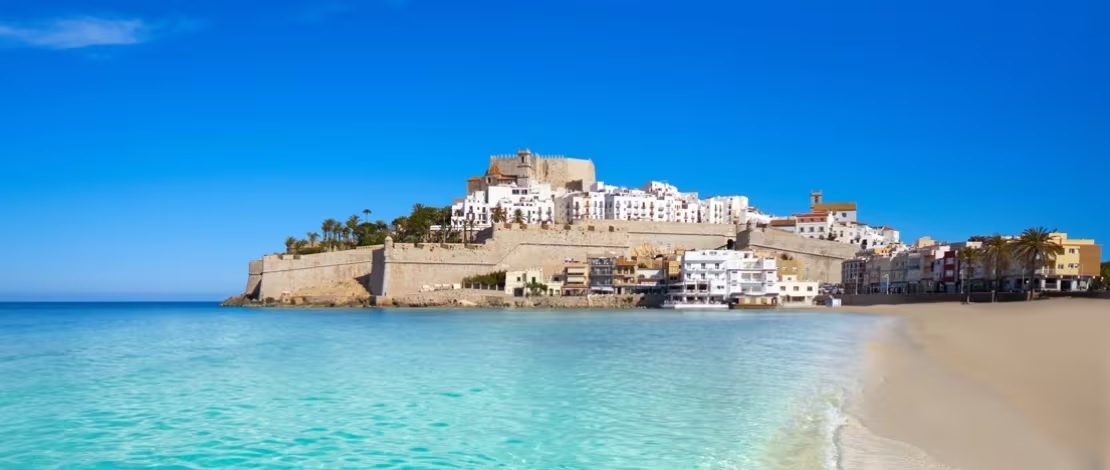
The Costa del Azahar’s province, Castellón, is one of the least inhabited coastal areas in Spain. The whole province is home to less than 600.000 people, mostly spread through small villages. Castellón de la Plana, its capital, has less than 200 thousand inhabitants; Benicasim, 20 thousand and Peñíscola, which has a gorgeous castle by the sea, has just over 8 thousand people – which doesn’t stop the city from having 25 visitors per habitant during summer!
Autonomous community: Comunidad Valenciana
Province: Castellón
Popular or main cities: Peñiscola, Benicasim, Castellón de la Plana
Closest airport: Valencia (VLC)
More about the coast: Castellón official website
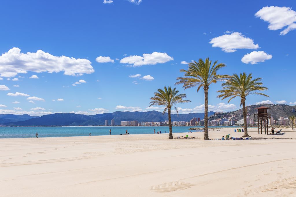
Costa de Valencia
The coast of the Province of Valencia used to be part of the Costa del Azahar, which encompassed both Valencia and Castellón provinces. The Valencians, though, decided to separate both coasts and named their own simply with the name of the province, perhaps because Valencia city was already popular enough to deserve its own Costa. As much of Spain, Costa de Valencia has seen a tourist boom that started on the 1950s.
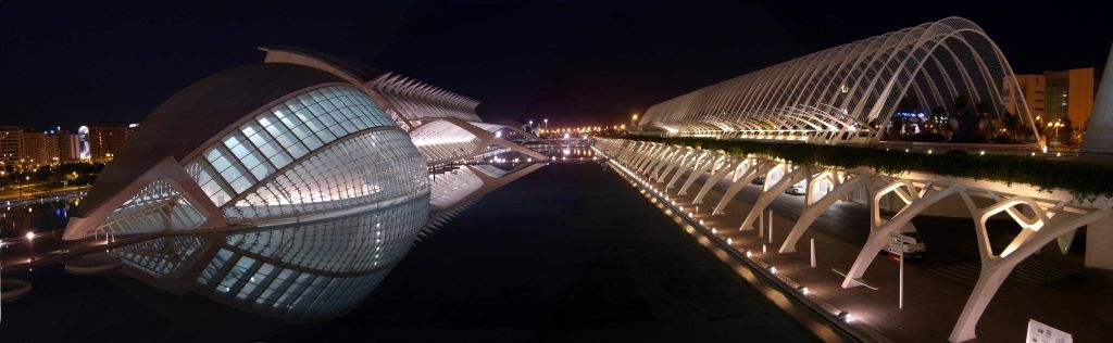
Valencia is a big city, the third most populated in Spain, after Madrid and Barcelona. It has both a large old town and Santiago Calatrava’s futuristic buildings, such as the famous Ciudad de las Artes y de las Ciencias (city of arts and science, above). Valencia is also a cosmopolitan coastal city that attracts both visitors and new residents every year. About 30 km away from Valencia is the town of Cullera, shown below:
Autonomous community: Comunidad Valenciana
Province: Valencia
Popular or main cities: Valencia, Cullera
Closest airport: Valencia (VLC)
More about the coast: Costa de Valencia at Spain info
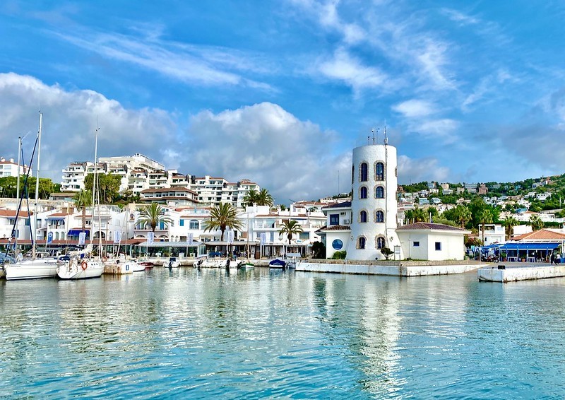
Costa Blanca
Costa Blanca (White Coast) is the name of the coast of the province of Alicante, a very popular area for beach and sun seekers, both as tourists and as expats. But what is the origin of the name? There are many theories going around the internet. One says the name has to do with the white sands and white houses of the area; another theory is that and the name was coined by British Airways in (the very specific year of) 1957; a third one points out that the region grows almond trees, and, in the past, there would be plenty of white almond blossoms along the coast.
Which one do you think is right? I believe that, as in the 1960s the government was naming the Spanish Costas with marketing purposes, the name probably came from an office, like with most of the coasts; but I like to think their inspiration may have been the almond blossoms.
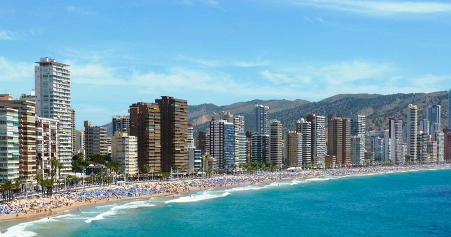
The fact is that the boom in tourism started with the offer of affordable holiday packages in the post-war UK, precisely in the 1950s-60s. Benidorm, in particular, managed to promote itself abroad and added a song contest festival to it, which became quite popular – Julio Iglesias won it in 1968. The city authorized beach side vertical construction (mostly of hotels) in order to keep up with the demand; many movies were set in the area and, more recently, the British TV series Benidorm (2007- 2018) contributed to the continuous promotion of the city. To this day, the city attracts lots of people from abroad – it is said that in Benidorm, you don’t need to speak Spanish!
Autonomous community: Comunidad Valenciana
Province: Alicante
Popular or main cities: Denia, Benidorm, Alicante, Torrevieja
Closest airport: Alicante-Elche Miguel Hernández (ALC)
More about the coast: Costa Blanca official website
Costa Cálida
Murcia got quite a good name for its coast: Costa Cálida (Warm Coast). And it makes sense. Sea temperature average in the area is above 25oC during summer – more than on any of the continental Spanish Costas. The warmer water region is the area of Mar Menor, a gulf-like formation (almost a lagoon) in the East of Murcia that is not reached by the cooler waters coming in from the Atlantic.
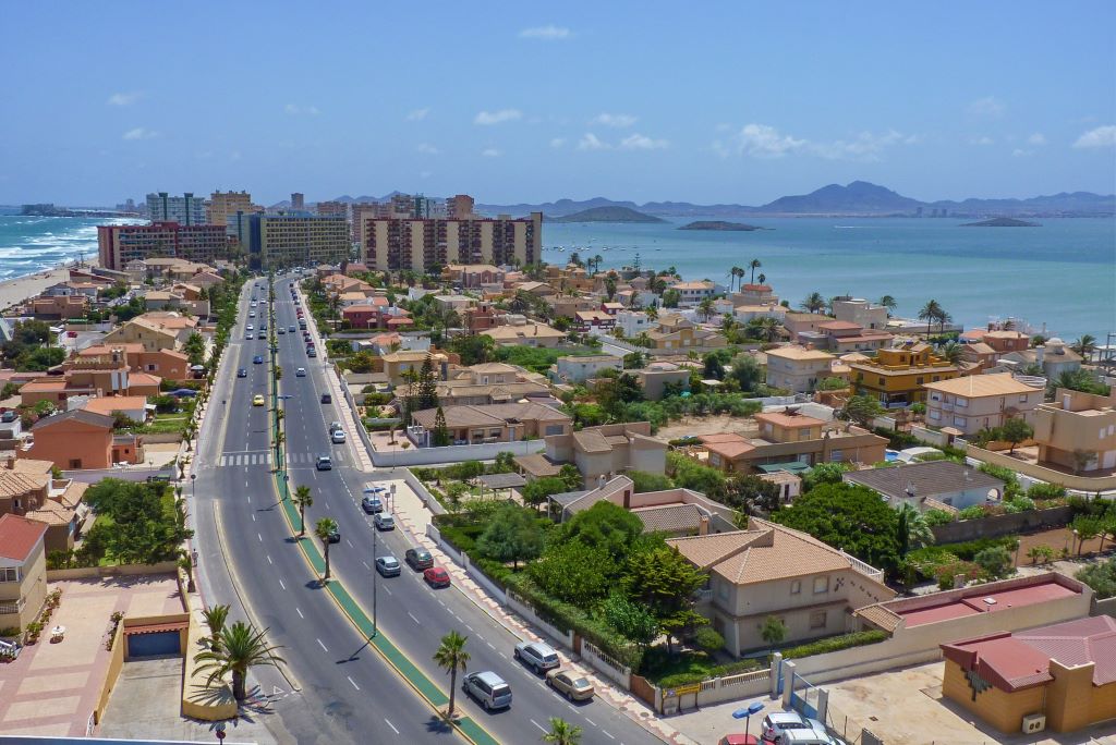
With warm waters, mud baths and the interesting La Manga del Mar Menor, which has the ocean on both sides and may cease to exist with sea rise – what stopped Murcia from becoming the most popular coast was probably a lack of investment is tourist-oriented infrastructure. The area is quite unique, with a desert – so you can count on no rain – and thousands of years of history. But beware; there are also swamped areas, which are natural mosquito-breeding areas. If you decide to visit Murcia, check also our post on silent mosquitos.
Autonomous community: Murcia
Province: Murcia
Popular or main cities: San Pedro del Pinatar, La Manga del Mar Menor, Cartagena, Mazarrón
Closest airport: Internacional Región de Murcia (RMU)
More about the coast: Murcia official website
Costa de Almería
The Costa de Almería, located in the province of the same name, is known for its stunning landscapes, diverse ecosystems, and charming coastal towns. Stretching approximately 217 kilometers, this coastline offers a blend of sandy beaches and rugged cliffs, providing visitors with a variety of options for leisure and relaxation. Almería is possibly the main producer of vegetables in Spain. These are cultivated in large greenhouses covered in plastic, which are visible from space (check the white areas surrounding Las Norias de Daza on google maps). This particular region (not the whole coast) is also known as mar de plastico (plastic sea).
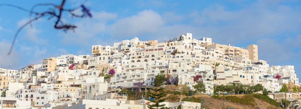
One of the standout features of the Costa de Almería is the Cabo de Gata-Níjar Natural Park, a designated UNESCO Biosphere Reserve. This protected area encompasses a diverse range of habitats, including volcanic landscapes, beaches, and clear waters. Nature enthusiasts can explore the park’s rich biodiversity, which includes rare plant species and a wide variety of marine life. The charming villages within the region, such as Mojácar and Almería city, offer a glimpse into the area’s rich history and culture.
Autonomous community: Andalusia
Province: Almería
Popular or main cities: Mojacar, Almería
Closest airport: Almería Airport (LEI)
More about the coast: Andalusia’s official Costa de Almería page
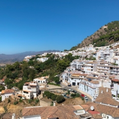
Costa Tropical
The inspiration behind Granada’s coast name, Costa Tropical (Tropical coast) is it’s microclimate, which allows for the cultivation of exotic fruits such as avocados, mangoes, and custard apples. It is also a very good marketing name that highlights the difference between Granada’s lush landscapes and its more arid eastern neighbors, Almería and Murcia. Ironically, the Costa Tropical is the place to go if you want to ski in Spain.
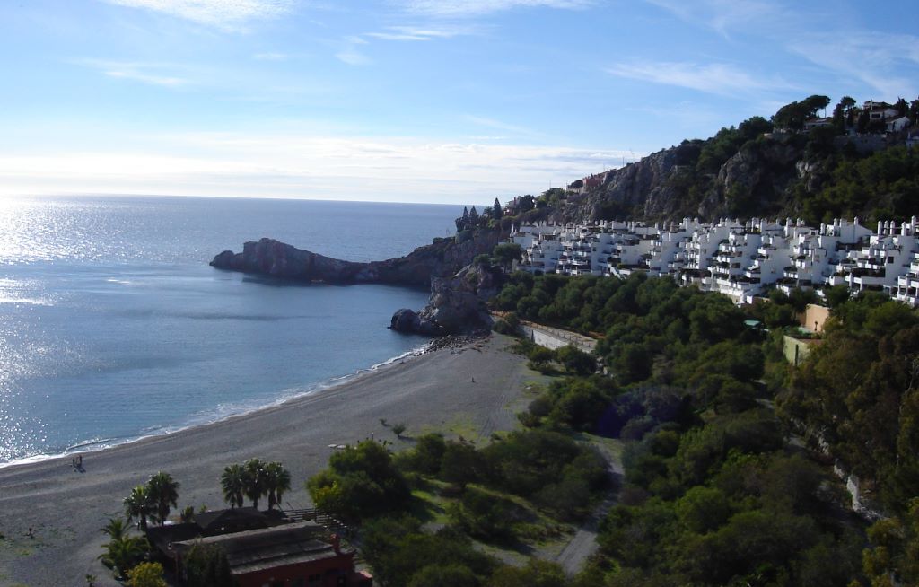
Nestled between the Sierra Nevada mountains, and the Mediterranean Sea, the region offers a blend of sandy beaches, mountains and charming villages. The town of Almuñécar is a notable highlight, featuring historical landmarks like the San Miguel Castle and the exotic botanical gardens of El Majuelo. Beyond the coastline, visitors can explore the scenic countryside and the nearby Sierra Nevada National Park, known for its snow-capped peaks and diverse flora and fauna, about one hour driving inland. The region’s rich history is reflected in the architecture of towns like Salobreña, where a Moorish castle perched on a hill offers panoramic views of the surrounding landscape.
Autonomous community: Andalusia
Province: Granada
Popular or main cities: Almuñécar, Salobreña, Motril
Closest airport: Federico García Lorca Granada-Jaén (GRX)
More about the coast: Andalusia’s official Costa Tropical page
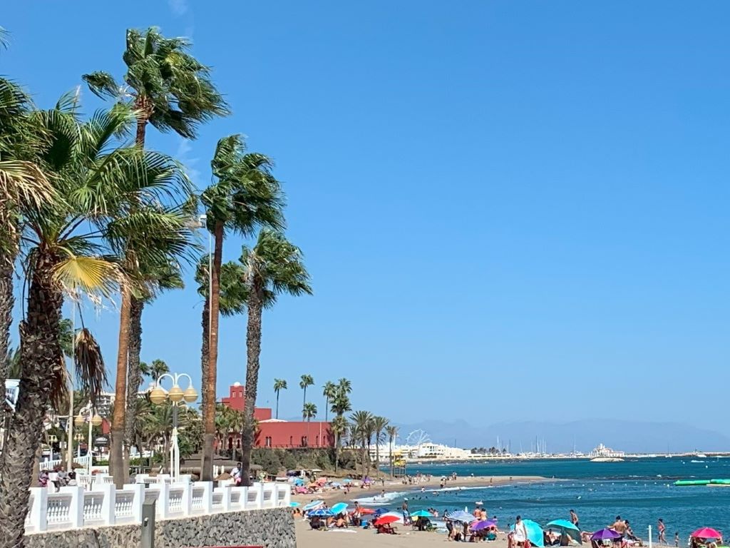
Costa del Sol
Home sweet home! The lovely and famous Costa del Sol (Sunny Coast) Is the amazing coast of Malaga province, and it stretches a bit further, all the way to the border with Gibraltar, in the Cádiz province. Together with Costa Blanca, these are (probably) the two most famous Spanish Costas.
But did you know that originally this coast was called Costa del Viento (Wind Coast)? As you may have guessed, it was changed during the 50s – 60s, for marketing purposes. And boy, both names fit. It is not every day, but every now and then a strong wind comes from the north and blows away anything that is on the terrace. In my home, our last notable flying object was a heavy 1m x 1m sofa cushion that now rests on top of the neighboring building. I’m hoping it will fly again soon and then I’ll recover it.
As a matter of fact, this Spanish Costa also has another nickname: Costa del Crime (Crime coast). It doesn’t apply to all of the Costa del Sol, but according to The Guardian, the famous Marbella has long been a sort of United Nations of crime, where mafias of all nationalities have their headquarters. It also turns out that Marbella has a much larger crime rate than the usual for a city of its size, according to the newspaper. It is worth noticing that the criminal part of Marbella seems to be concentrated on the most upscale part of the city – Puerto Banús, Golden Mille – and that Marbella is much more than just this tiny area.
Another nickname of the Costa del Sol is Costa del Golf. This coast is indeed a paradise for golf lovers, with several courses per city. A real estate agent once told me that golf was Malaga’s idea to combat seasonality – you see, the Costa del Sol was already a world-renowned destination during summer, but during other parts of the year, the movement of tourists fell by half. Building high-level golf courses was the Costa del Sol’s way to attract people during the other seasons, when the temperature is not so high, and golfing would be pleasing. 😉 I think it worked.
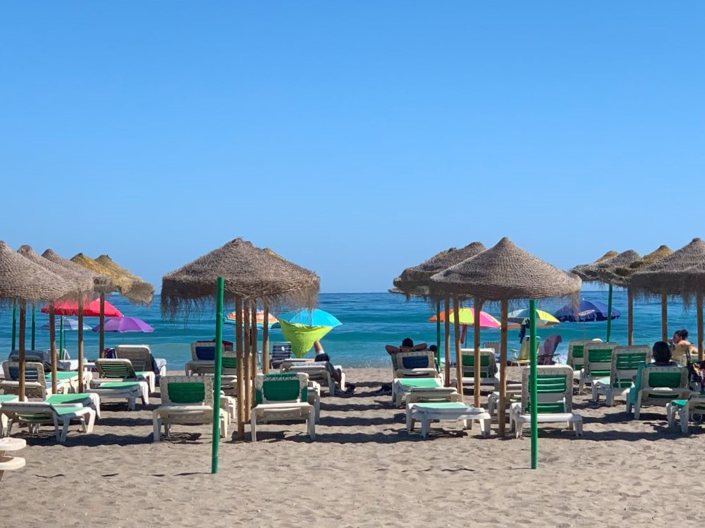
The Costa del Sol mixes sandy and rocky beaches along its sun kissed shores. It has more than 300 days of beautiful sunshine and blue skies, and the cities – lined with flowers – have a great infrastructure to support tourism, with plenty of hotels, information centers and restaurants of many different cuisines.
My favorite part, though, are the celebrations. From April to October there are plenty of Ferias in the Costa del Sol; November to January is filled with Christmas celebrations, and February has the carnival… The area mixes small white villages with large cities, such as Malaga. Beyond the sun and sand, the region boasts a rich cultural heritage, with historic sites such as the Alcazaba fortress in Malaga and charming old towns.
Autonomous community: Andalusia
Province: Malaga
Popular or main cities: Nerja, Malaga, Torremolinos, Benalmadena, Fuengirola, Mijas, Marbella and Estepona.
Closest airport: Malaga Airport (AGP)
More about the coast: MamaMalaga 🙂 and also Andalusia’s official Costa del Sol page
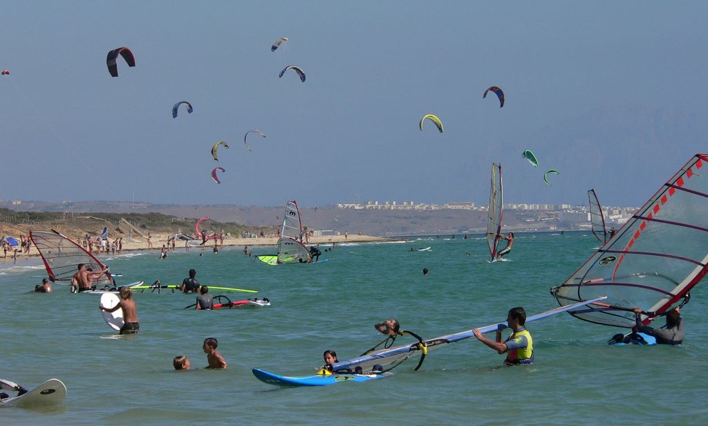
Costa de la Luz
The Costa de la Luz (Coast of Light) received its promotional name in the 1950s-60s, as did many of the other coasts. The inspiration may have been the fact that, as it is the peninsular coast that reaches the southernmost part of Spain, it is the coast with more sunlight. Spanning the provinces of Cadiz and Huelva, this coastal region is characterized by its expansive stretches of sand that meet the Atlantic Ocean, unlike its Mediterranean counterparts.
The Costa de la Luz is known for its wild and untamed nature, where rolling dunes and pine forests frame the coastline. Popular destinations along this coast include the historic city of Cadiz, known for its ancient architecture and vibrant street life, as well as the laid-back beach towns like Tarifa, renowned for its windsurfing conditions and a mix of Moorish and Andalusian influences.
Beyond its natural allure, the Costa de la Luz boasts a rich cultural heritage shaped by centuries of history. The region witnessed the arrival of Phoenicians, Romans, Moors, and more, leaving behind archaeological treasures and diverse traditions. Vejer de la Frontera, a beautifully preserved white-washed village perched on a hill and one of the most beautiful pueblos (villages) of Spain, exemplifies the region’s Moorish past with its narrow cobblestone streets and medieval architecture. The Costa de la Luz not only entices sun-seekers with its unspoiled beaches but also beckons those seeking an authentic Spanish experience, blending history, nature, and a relaxed coastal lifestyle.
Autonomous community: Andalusia
Provinces: Cádiz and Huelva
Popular or main cities: Cadiz, Tarifa, Vejer de la Frontera
Closest airport: Jerez Airport (XRY) is close to the Cádiz portion of this coast; Sevilla Airport (SVQ) is closer to parts of Huelva province’s Costa de la Luz
More about the coast: Andalusia’s official Costa de la Luz – Cadiz and Costa de la Luz – Huelva pages
The East and North Spanish Costas
Rías Bajas
The Rías Bajas (lower estuaries), located along the coast of Pontevedra province and south of La Coruña province in Spain, constitutes a stunning and unique coastal landscape renowned for its natural beauty. The name Rías Bajas refers to the series of intricate, branching estuaries that carve into the coastline. These estuaries are formed by the submersion of river valleys due to rising sea levels during the last ice age, creating a network of fjord-like inlets that extend inland. The resulting landscape is a blend of lush green hills and pristine beaches, making it a popular destination for both locals and tourists.
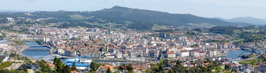
The region’s mild maritime climate, influenced by the Atlantic Ocean, contributes to the flourishing vineyards that produce Albariño, a crisp and aromatic white wine characteristic of the area. The Rías Bajas are not only a haven for nature enthusiasts but also a culinary paradise, celebrated for its fresh seafood and the traditional Galician dish known as “pulpo a la gallega” or octopus Galician style. Visitors can explore charming towns like Sanxenxo, known for its historic architecture and vibrant local atmosphere.
Autonomous community: Galicia
Province: Pontevedra and La Coruña
Popular or main cities: Pontevedra, Sanxenxo
Closest airport: Vigo Airport (VGO)
More about the coast: Rías Bajas official page
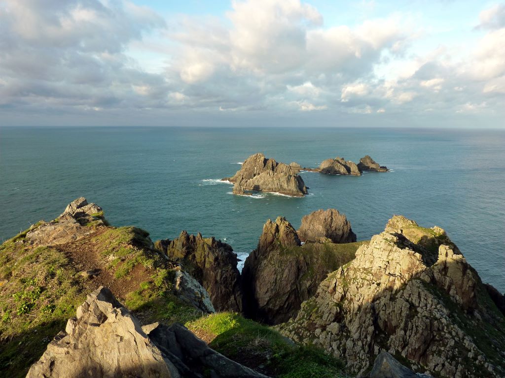
Costa de la Muerte
The Costa de la Muerte (Coast of Death) is a rugged and windswept stretch of coastline in the province of La Coruña. The name stems from the treacherous conditions that have historically posed significant dangers to sailors navigating these waters. The coastline is known for its powerful and unpredictable Atlantic storms, strong currents, and rocky cliffs that have resulted in numerous shipwrecks during the 18th and 19th centuries. The British were the first to name the place, by putting it on a Nautical chart in 1907.
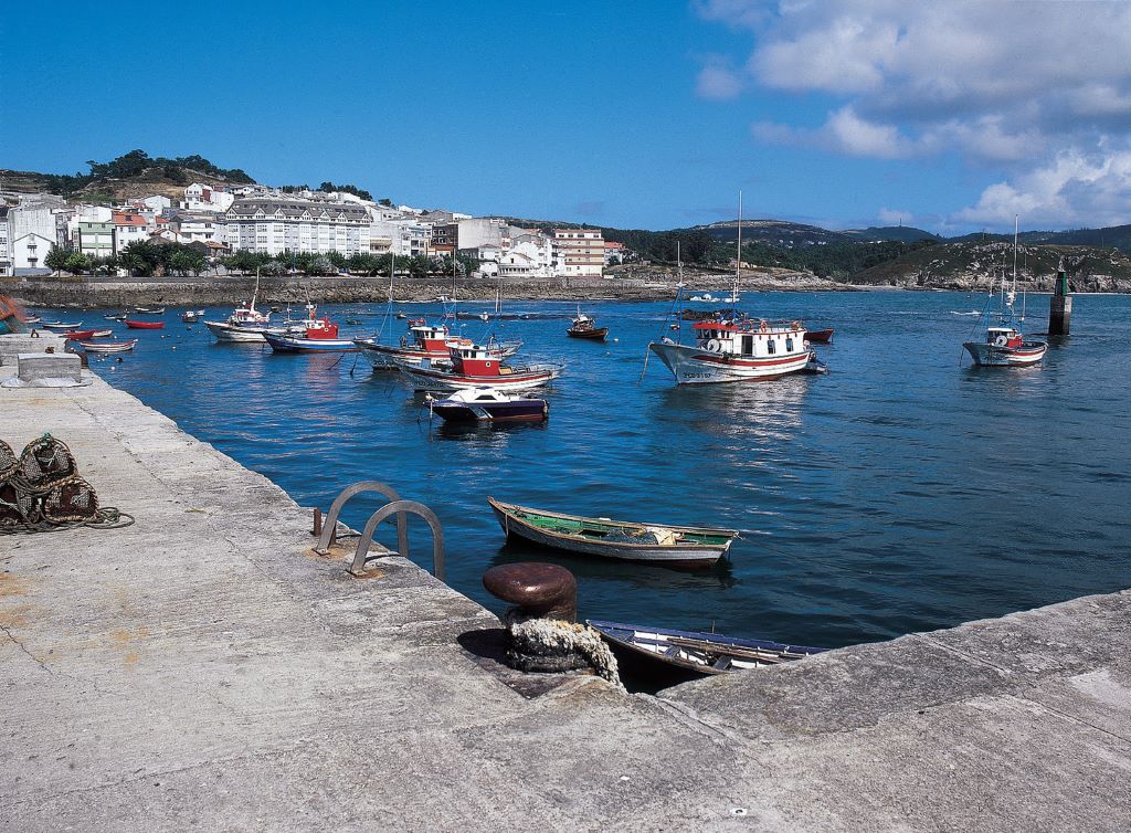
Despite its ominous name, the Costa de la Muerte is also known for its stark natural beauty, with dramatic cliffs, secluded beaches, and fishing villages dotting the landscape. The area attracts adventurers and nature enthusiasts seeking an authentic and unspoiled coastal experience. Visitors can explore Cape Finisterre, which the Romans thought was the end of the world, and witness the breathtaking sunsets that have captivated travelers for centuries. The Costa de la Muerte serves as a reminder of the formidable power of the sea and the resilience of the coastal communities that have navigated its challenges throughout the ages.
Autonomous community: Galicia
Province: La Coruña
Popular or main cities: Malpica, Ponteceso
Closest airport: A Coruña (LCG)
More about the coast: Junta de Galicia
Rías Altas
The Rías Altas (upper estuaries), located along the northern coast of La Coruña and all the coast of Lugo, form a captivating coastal landscape characterized by deep estuaries, cliffs, and beaches. The name Rías Altas highlights the contrast with the Rías Baixas, which are the lower estuaries located to the south. These estuaries, like those in the Rías Baixas, were created by the submersion of river valleys during the last ice age, resulting in a series of fjord-like inlets that extend inland. The Rías Altas offer a diverse and rugged terrain, providing a haven for nature enthusiasts and those seeking a less-explored corner of Spain’s coastline.
One of the prominent features of the Rías Altas is the Ortegal Cape, a majestic headland that marks the northernmost point of the region. This cape is known for its towering cliffs and the unique “Cariño’s Hermitage,” a chapel perched on the edge of the cliffs with panoramic views of the Atlantic Ocean. The Rías Altas are also famed for their beaches, such as Playa de las Catedrales, known for its impressive rock formations and tidal caves.
Autonomous community: Galicia
Province: La Coruña
Popular or main cities: La Coruña
Closest airport: A Coruña (LCG)
More about the coast: Rias Altas official page
Costa Verde
The Costa Verde (Green Coast) stretches along the province and autonomous community of Asturias. The name Costa Verde dates back from the 1960s and highlights the lush green landscapes that characterize this region, with rolling hills, dense forests, and vibrant meadows. The coastal climate, influenced by the Atlantic Ocean, has a high amount of rainfall; that is what keeps it green, and the reason why this coast receives a relatively small amount of tourists. The Costa Verde is celebrated for its natural beauty, with rugged cliffs and beautiful beaches, against a backdrop of green mountain ranges. One of such mountain ranges is the Picos de Europa, inland.
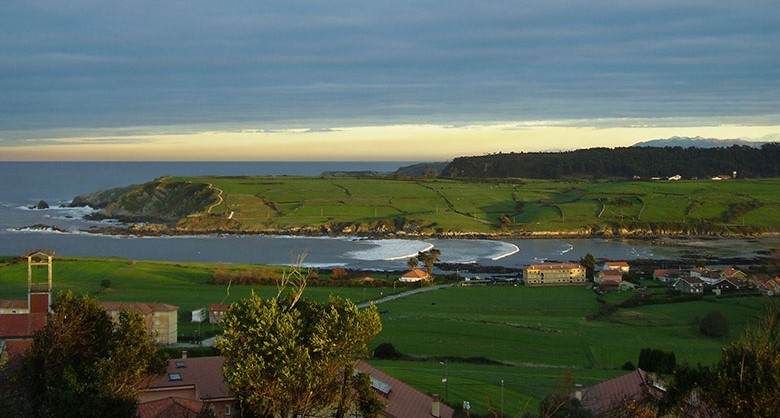
Playa de Bañugues, Gozón. Image from Turismo Asturias.
The region is also known for its seawater geysers (in Spanish: bufones) – a unique natural formation carved over ages of water beating against rocks. Hollowing winds and jets of seawater up to 20 meters tall come through the natural holes. The jets, located by the shore near the village of Puertas de Vidiago, happen more often on stormy days.
Autonomous community: Asturias
Province: Asturias
Popular or main cities: Gijón
Closest airport: Asturias Airport (OVD)
More about the coast: Costa Verde official page
Costa de Cantabria
The Costa de Cantabria, in the province of the same name, is similar to the Costa Verde, in Asturias. They share the same climate and have similar landscapes – minus the geysers. But Cantabria’s coastal cities tend to be larger than those in the Costa Verde, which gives the prospective tourist the luxury of choosing between a more or a less developed urban environment.
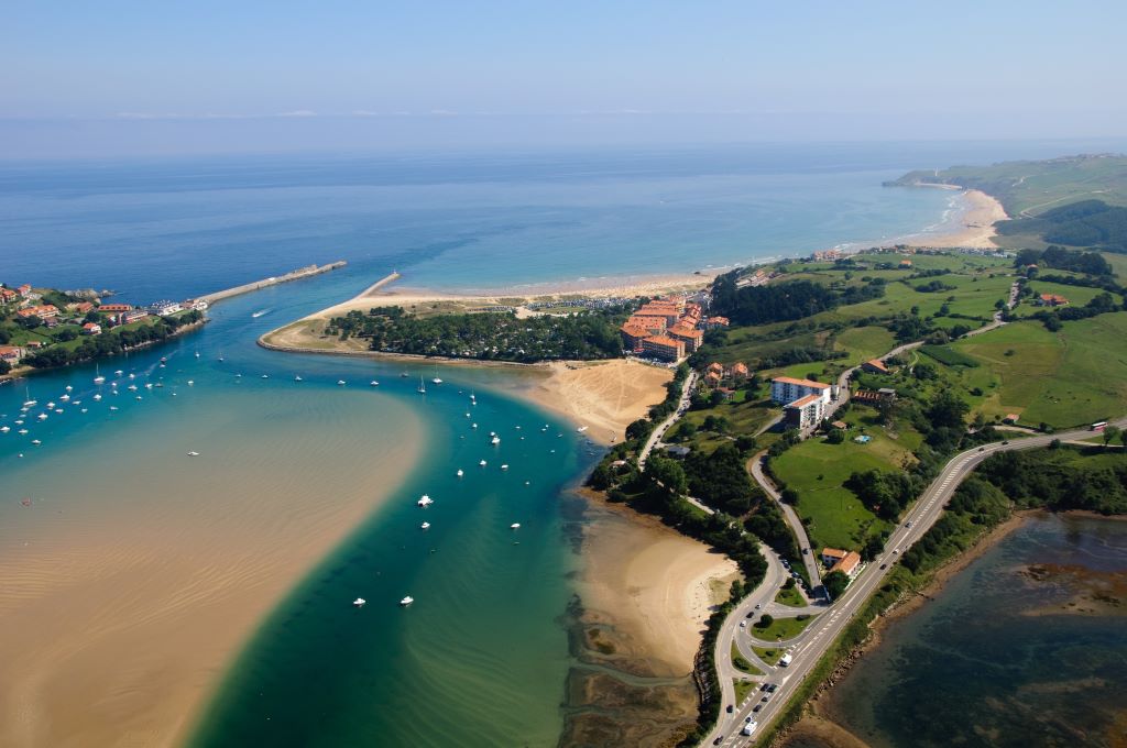
The coastline is dotted with picturesque towns and cities, each offering a unique blend of historical charm and maritime traditions. Santander, the capital of Cantabria, is renowned for its elegant seafront promenade, beautiful beaches like El Sardinero, and the historic Magdalena Palace. San Vicente de la Barquera, another coastal gem, boasts a medieval bridge, a charming old town, and stunning views of the Cantabrian coastline. Visitors to the Costa de Cantabria can explore the region’s rich cultural heritage, indulge in fresh seafood, and enjoy outdoor activities such as hiking and surfing.
Autonomous community: Cantabria
Province: Cantabria
Popular or main cities: Santander
Closest airport: Seve Ballesteros-Santander (SDR)
More about the coast: Costa de Cantabria official webpage
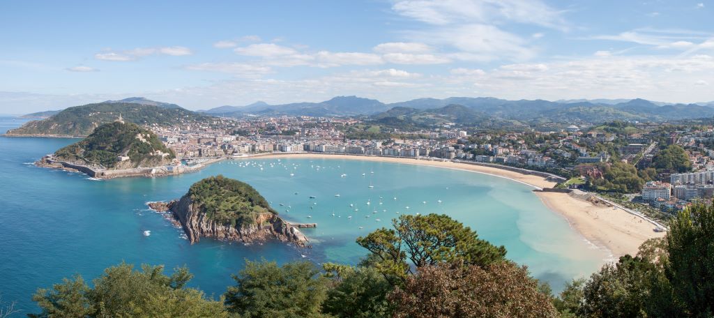
Costa Vasca
The Costa Vasca (Basque Coast) extends along the northern part of Spain’s Basque Country (which is not really a country but has that name). It comprises cities like San Sebastián, Bilbao, and Zarautz. This coastal stretch is renowned for its diverse landscape of scenic cliffs, beaches, and vibrant urban centers. The Cantabrian Sea, part of the Bay of Biscay, shapes the region’s climate, providing a temperate and oceanic environment that influences both the weather and the local way of life.
(Off-topic: this picture reminds me of Rio de Janeiro, in Brazil, which, coincidently, is also dedicated to the same saint.)
The Costa Vasca is known for its cultural richness and culinary excellence. San Sebastián is famous for its stunning La Concha beach, the historic Old Town with its pintxos (Basque tapas) bars, and the picturesque Monte Urgull. Bilbao, a major urban center along the coast, houses the iconic Guggenheim Museum, which has become an architectural and cultural symbol.
Autonomous community: Basque Country
Provinces: Vizcaya and Guipúzcoa
Popular or main cities: San Sebastián, Bilbao, Zarautz
Closest airports: Bilbao (BIO), San Sebastian (EAS)
More about the coast: Costa Vasca official page
Conclusion
Wow, this was quite a trip! Spain has such a diversity of coastal areas – some tranquil, some bustling, all full of nature, but with such a diversity of natural environments, from the lush green of the north to the arid southwest; cliffs and sandy beaches in every single coast; areas very developed, where one can relax by the beach and just move to get a pint, but also places were exploration and hiking are the norm. I hope you enjoyed the Spanish Costas; there is certainly one (or maybe 18?) that caught your heart. Let me know which one was your favorite; with so many good options, it’s hard to choose. I’m already planning my next vacation…

You may also like...

Effective ways to know your cost of life in Spain
Talking about cost of life in Spain can be complicated, but I have a few tricks up my sleeve that... Continue reading
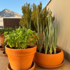
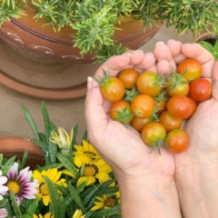
Terrace Gardening in Spain – what to plant, pots, walls, shops and care
Terrace gardening in Spain – I would love to live in a house with a vast garden; but I live in... Continue reading
Best places for families to live in the Costa del Sol
Have you ever wondered what are the best places for families to live in the Costa del Sol? That’s a... Continue reading
The truth about finding long term rent in Spain
If you find it hard to find a long term rent in Spain, you are not alone. Everywhere we look... Continue reading
24 things to do for free in the Costa del Sol
In this list of things to do for free in the Costa del Sol, we're about to reveal a treasure trove of activities... Continue reading
Siesta in Spain: the cultural icon (that stops street commerce)
Siesta in Spain is real. Have you ever heard or read that in Spain everything stops during la Siesta? If... Continue reading